


When you become a Member of Safe Harbor, you have access to our entire network of premium locations, amenities, events and unparalleled boating lifestyle opportunities.
 Menu
Menu
Safe Harbor
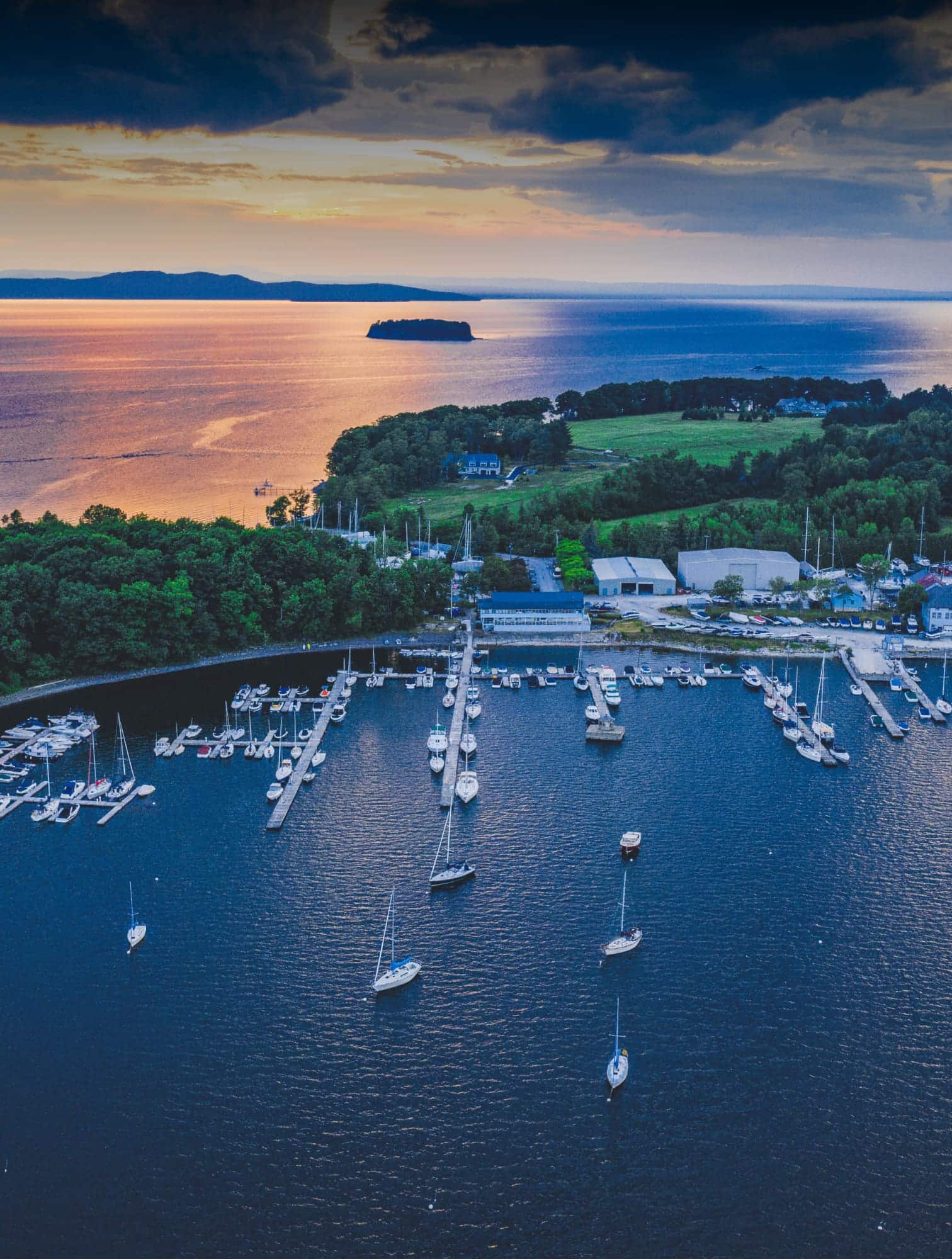
Plymouth


Rich colonial heritage and legendary boating are close at hand. Centrally located on the Massachusetts coast, Safe Harbor Plymouth enables a convenient departure point for exceptional cruising and fishing grounds. Take an afternoon stroll to town and explore the many historic monuments and pubs, or simply dock your boat and take in a beautiful New England sunset.
Wet Slips
Length Overall
18' - 150'
Max Height
UNRESTRICTED
Max Beam
25'
Max Draft
8'
Available at Your Slip
- Complimentary Wi-Fi
- Shore Power Hookups
- Fresh Water Hookups
- Pump-out
Transient Slips
Length Overall
18' - 150'
Max Height
UNRESTRICTED
Max Beam
25'
Max Draft
8'
Available at Your Slip
- Complimentary Wi-Fi
- Shore Power Hookups
- Fresh Water Hookups
- Pump-out
Dry Storage
Length Overall
23'
Max Height
10'-65'
Max Beam
22'
Max Weight
2 tons
Your Dry Storage Includes
- Valet Launch & Haul
- Fire-Protected Facility
Winter Storage
Length Overall
10' - 65'
Max Height
30'
Max Beam
22'
Max Weight
70 tons
Options
- Indoor Heated
- Outdoor
Your Winter Storage Includes
- Winter Haul Out
- Spring Launch
- Jack Stands
- Blocks
- Fire-Protected Facility
- Secure Facility
- 35T & 75T Travel Lifts
Marine Service
We ensure your boat is cared for with passion and meticulous attention to detail.
Capabilities
- Painting/Refinishing
- Winterizing Solutions
- Rigging & Derigging
- Canvas Shop
- Carpentry Services
- Boat Projects/Builds
- Welding
- Fiberglass Services
- Mechanical Services
- Restoration/Repair
- Systems Repair
- Electrical Services
- Certified Technical Staff
- Commercial/Recreational/
Competitive Yacht
Facilities & Equipment
- Hoists / Lifts
- Crane
- Spray Booth
- Large Full-Service Facility

Fuel Dock
Features
- ValvTect Marine Gas
- ValvTect Marine Diesel
Ship's Store
Features
- Boat Supplies
- Oxxean Dingies
Boat Brokerage
When it’s time to buy or sell a boat, onsite brokerage makes it easy and convenient. Please contact our local brokerage partners for details.


Featured Amenities


show less
see more

What People Are Saying
-
Described as the best marina on the New England coast, and with good reason. Amazing, friendly, competent staff, best slips and things to do within walking distance when you come in by boat, best marine mechanics anywhere.
-
-
We are currently cruising the New England coast and had the pleasure of staying at Safe harbor Plymouth. I wanted to reach out and share how amazing of an experience I had with the dockmaster Stevie and his crew of dockhands. Great communication before my arrival of how to safely enter the marina. The guys were standing on the dock waiting to assist us with lines as we arrived as well as hooking up shore power and water. The dock hand Mike was especially friendly and helpful and always seemed excited and happy to help us with anything we needed. I hope to be able to return to Plymouth soon to work with their team again. Have a happy Fourth of July!
-
-
-
-
-
-
Best views in town, awesome cocktails, friendly staff, delicious food! The blackened salmon tacos are my favorite!!!
-
-
Recently took shelter at (aptly named) Safe Harbor in Plymouth and can't enough about this place. Bridgette and the entire staff were extremely helpful and professional. Highly recommended!
-
Join us.
To inquire about becoming a Member, please share your information. We’d love to hear from you.


- Monday
- 8:00 am - 4:30 pm
- Tuesday
- 8:00 am - 4:30 pm
- Wednesday
- 8:00 am - 4:30 pm
- Thursday
- 8:00 am - 4:30 pm
- Friday
- 8:00 am - 4:30 pm
- Saturday
- Closed
- Sunday
- Closed
Close
![Map of Surfside Smokehouse]()

![Map of Pilgrim Memorial State Park]()
![Map of Boating Attractions]()
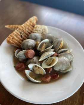
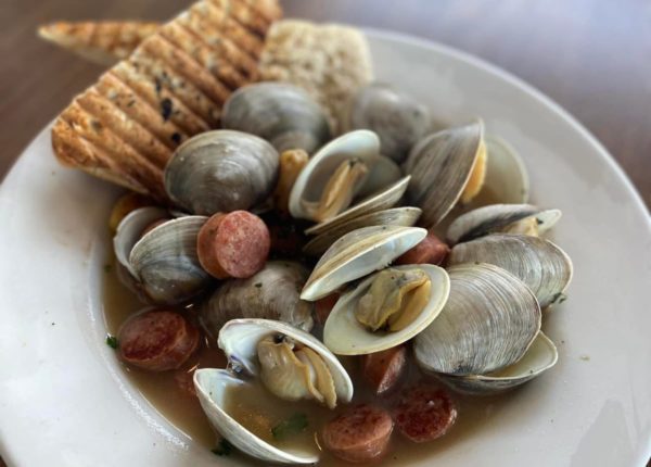
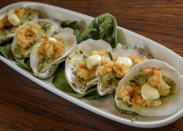
Surfside Smokehouse

Conveniently located onsite, this casual dockside restaurant is where “surf meets turf.” Serving up fresh daily catches and tantalizing BBQ dishes, this spot is perfect for enjoying a relaxing meal after a day on the water. The menu features delicious options like crab cakes, coconut shrimp, pulled pork, and brisket along with excellent raw bar options. Be sure to check on the rotating lineup of live entertainment to catch the best local talent in action.

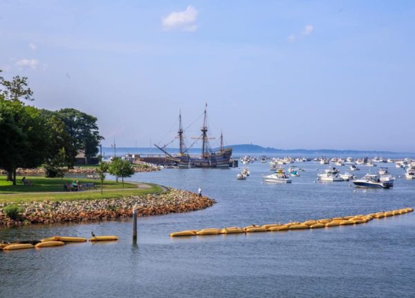
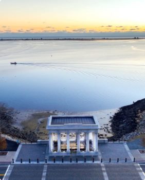
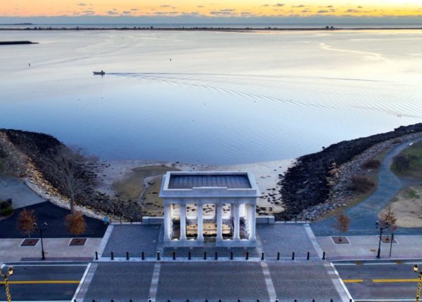
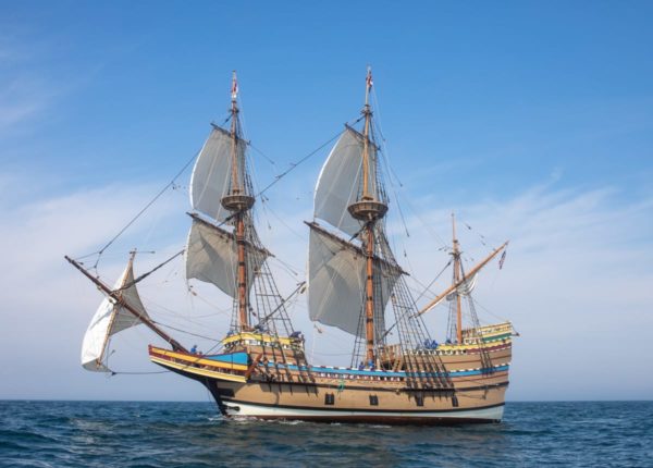
Pilgrim Memorial State Park
Home of Plymouth Rock and the Mayflower II Museum, this historic park draws over 1 million visitors each year. Learn more about the 1620 voyage of the Pilgrims and other fascinating historical milestones while taking in stunning views of Plymouth Harbor. A great spot to spend an afternoon exploring.

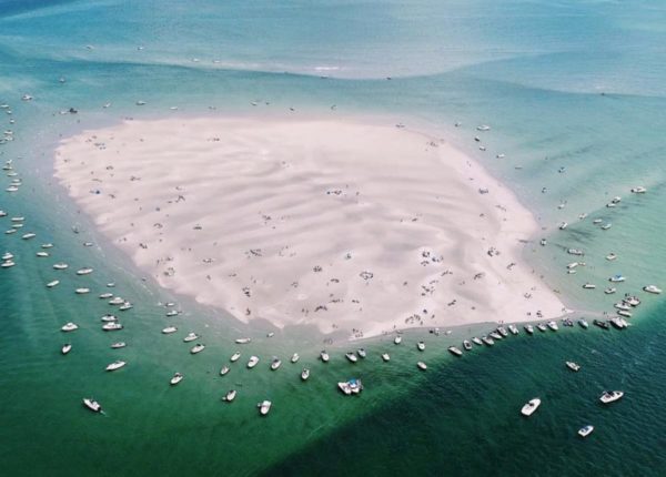
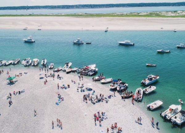
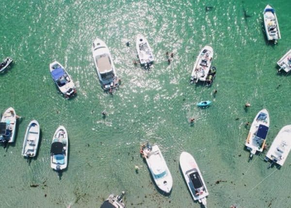
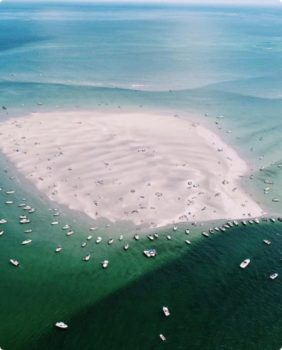
Boating Attractions
For a little slice of paradise all your own, cruise on over to the bay’s sprawling sandflats, where boaters like to intentionally beach themselves and spend a few unbothered hours in the sun. Brown’s Bank is one of the best among them, ideal for anglers looking to reel in their fair share of stripers, bluefish, and flounder. Visitors also have fun exploring the tidal pools and channels, digging for clams, swimming, and playing games on the beach.